Friday, December 23, 2016

The Berry Islands


The Berry Islands lie 80 miles to the east of Bimini and, while beautiful, are often ignored by cruisers heading to the more exotic Exumas.   On a recommendation from a local, we headed there from Bimini on Wednesday (12/14) across the plateau known as the Great Bahama Bank with depths of only 10-15 feet over light, sparkling turquoise water.  The sea was flat calm, and we sped along at 20 knots per hour over the turquoise.  We arrived at the northernmost two islands, Little Stirrup and Great Stirrup in 4 hours.  Both small islands are owned by large cruise ship lines and are promoted as “Tiki villages”. 
Two ships were anchored off the islands, and we saw passengers being ferried ashore for food, drink, sunbathing, swimming, snorkeling, water slides, jet skiing, parasailing, and every imaginable island delight. So strange to see these manmade tropical islands virtually dropped in the middle of natural ones. We also saw large construction equipment and barges hauling sand to create new island paradises.


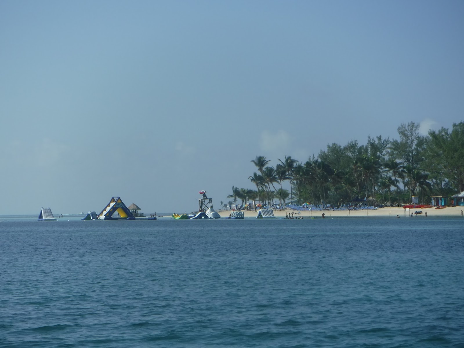
After anchoring some miles away we put our tandem kayak in the water and explored a lagoon on one side of the cay and saw rolling surf just over the rocks.  Sting rays, small sharks and large turtles swam near the kayak.  We then paddled over to a pristine beach on the uninhabited Hawksnest Cay, finding another conch and sea fans for my collection. The conch had a dime sized hole, indicating it had been discarded after being harvested for its meat.
We took our chairs up to the bow of our boat, watching the afternoon turn to night with a beautiful sunset.  Then the super moon rose over the water.  Everything in paradise was perfect, or so we thought.  Unbeknownst to us, the boat had been invaded by hundreds of no-see-ums.  During the night I was badly attacked, while Bill was unaffected. Over the next couple of days, Bill was on the war path to get rid of the remaining invaders, but it was many days before I didn’t look like I had the worst case of poison ivy. Apparently some people are badly allergic to these tiny monsters, but most don’t seem to be.


Our next stop south of Hoffman’s Cay was a cove complete with a beach, coral cliffs and crashing breakers on the outside of the protection.  [That evening we would move because the swells were rocking the boat too much for comfort.] 
We motored ashore, combed
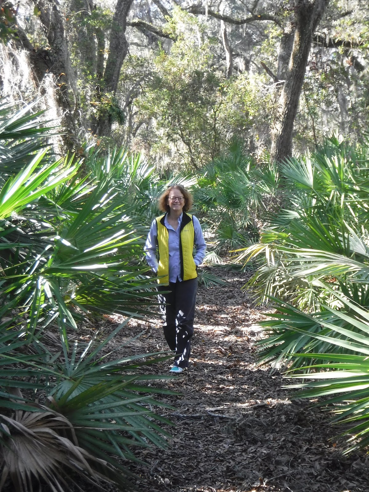
 the beach for more shells and took the jungle trail to the Blue Hole, a grotto, which is a large hole of great depth filled with water. 

 On Friday (12/16) we had planned to continue south to one of the three marinas in the Berry Islands, but in speaking on the VHF radio we learned that the two southernmost marinas are closed due to severe damage from Hurricane Matthew. In fact, one of them might have been closed for years, but the boating guide lists them as still open. The one remaining marina on Great Harbor Key was 20 miles orth of us and the only one within 50 miles in any direction. We were quite low on gas, so we had to backtrack to get fuel. This was a good lesson that we need to call ahead to ensure that gas is available. 

Great Harbor Cay proved to be a nice place to visit as the main village has not been materially impacted by tourists or the boating community.  We road our bikes through the village just as the uniformed children were getting out of school.  Everyone was very friendly but the children did get a good belly laugh when my front tire hit a pot hole and I fell off my bike.  We met more lovely couples in Great Bay Cay and we are all exchanging our cards, expecting to see one another again later in the trip, or maybe another year. Maybe some of our new friends will come to visit us in Maine!

The next morning we left with full gas tanks and headed back to where we had started the day before.  The wind had picked up from the SE, and the seas were rough, particularly in the guts between islands. We had read about Little Harbor Cay and were intrigued by a description of a little restaurant on the island called Flo’s.

Fresh conch being brought to Flo's.


Conch shells line the shore on both
sides of Flo's Restuarant.
This little restaurant has been in operation for many years. Flo’s  son, Chester, runs this little spot today. He likes at least 3 hours notice by radio that he will be having lunch or dinner guests. He and his assistant, Candy, then prepare conch or whatever local fish they have available and a rum punch that takes you away (I guess we’re already away!). The walls on this little establishment are covered with dollar bills, signed by previous guests, some apparently quite famous. The shore is littered with thousands of conch shells deposited over the years.  


Moored near us was the 42-ft sailing catamaran owned by Bernard and Claude, both French, now living in Ontario.  We enjoyed cocktails on their Bernard-made boat and over the next three days met several other boating couples, some retired but also younger couples who work seasonal jobs allowing them 6 months off a year to pursue their dream of cruising.  Thus far, almost all of the cruisers we have met in the Bahamas are Canadian.

We had a relaxing 3 day stay in this quiet anchorage with our new found friends. I had been terrified of going in snorkeling off the boat. As much as I had looked forward to it, when the time came, I was haunted by the words of the old pros. Every person I had spoken to had told me not to worry about the sharks. If a large shark swims up to you, just punch it in the nose and it will swim away. Yeah, sure! But…  the barracudas! Our friends Claude and Bernard agreed to take us for our first swim. 

 I felt safe with them. They have been all over the world and have are very comfortable in the sea. I finally got in with my brand new snorkel gear and instantly loved it. The water is crystal clear and about 78 degrees. We saw small colorful fish, lobsters, conchs and other little sea creatures. No barracudas! No sharks either, for that matter. 
Dinner with Bernard and Claude at Flo's


On our last night in the anchorage, we ate again at Flo’s with our friends. After dinner we walked down the reef trail to our dinghy and watched Chester cleaning fish. He was throwing the guts in the water and we could see 10 sharks circling, waiting for their tasty treat. Maybe not dangerous, but I had just as soon not have to punch one of these big guys in the jaw!
Preparing our dinner.

Sharks all around


Today we left with the sailboats to head to Nassau. After a short delay caused by running aground in this shallow spot at low tide, we set off across the deep blue to our destination. The tides and wind made for an extremely rough trip. Everything on the boat got soaked. We realized that the weather the sailors prefer is probably not the best for us. After drying out, we are now anchored off a cay about 8 miles from Nassau and Paradise Island, and will head there on Thursday (12/22).

Saturday, December 17, 2016

On to the Bahamas!


So the big day had finally come. We had been planning on a Tuesday crossing for 4 or 5 days based on Marv's Weather Service. The day did indeed dawn clear and calm.

I had to set my fears aside, because there was no turning back. We woke early and set off quietly from the Marina just before dawn. We crossed Biscayne Bay, aiming for Stick Village. This was a group of houses built on stilts in the middle of the bay. We were told that they were built in the 30s during Prohibition, and were used as places to party and drink alcohol. There are only 6 of these houses left. The area is now a national park and owners are not allowed to replace them or change the houses.

 The trip was uneventful. We were able to maintain 22 mph the entire 3 1/2 hour trip. Its an eerie feeling to not see land and usually no other boats for such a long time. Actually, the trip was much shorter for us than for sailboats, which can take 20 hours or so to cross. I asked Bill to not report the ocean depth. For some reason 3000 feet to the bottom is far more frightening to me than 30! We crossed the Gulf Stream, which is about 25 miles wide. The current runs at 3-4 knots and take a slower boat way off course. We noticed the current, but had no problems crossing. The ocean temperature has been 75-79 degrees since Florida.

We finally saw land, and then the water started becoming lighter and completely clear, allowing us to see to the bottom. Darker water is over coral or grass, lighter green is over sand and tannish green is 1-2 feet over sand. We went through customs on North Cat Cay, part of the Bimini Islands, where Bill was allowed off the boat, but I had to stay on. While Bill was gone, a couple motored up next to our boat, asking if they could take pictures. They could not imagine that our little Salty Paws could have travelled 2400 miles from Maine. This island is private, as are most of the Bahama islands, with a fancy club and about 30 houses. Bill was told that only 9 houses are occupied now, but the season starts after Christmas and the owners will start arriving then.
We left North Cat and slowly motored to Gun Cay where we anchored in Honeymoon Harbor. Large stingrays were clearly visible in the water swimming up to our boat. There was a sailboat anchored in the harbor and 3 women sunbathing on the beautiful beach. We kayaked to the beach and I apologized to the women for disturbing their peaceful visit on this otherwise deserted island.


As we are watching the stingrays coming to shore, I realized that I am quite nervous about getting in the water with creatures I am not familiar with.  The young woman, who is from Austria and living in the Bahamas with her boyfriend, told us that stingrays are actually quite friendly and you can feed and stroke them. We walked out into the water and were immediately approached by six of them, who swam right up to us, feeling our legs with their wings. OK, first fear allayed. We kayaked back to our boat, and within an hour or so, the sailboat left. We were alone on a deserted island for the night. We had to re-anchor twice to get into a calm spot without having to worry about the anchor dragging.


On Wednesday (12/14) we took off on the 80 mile trip to the Berry Islands, across the Bahamian plateau where the water is an indescribable color and depths range from 8 to 20 feet.   Our Internet connection is very slow right now and we will post about the wonderful Berry Islands at a later date.


Monday, December 12, 2016

Manatees, Obulence and Cruise Ships

A little cloudy but there is a 10 foot manatee there in the water.
After our exciting night in the bay off Canaveral, we thought we should push it to get down to the Miami area for our jump off spot to the Bahamas. We made it to Fort Pierce which turned out to be a beautiful spot and we ended up staying 2 nights in a nice marina. We saw our first manatee and many big, beautiful fish swimming near our boat.
We ate at the Tiki Bar next to the marina and had yellow snapper. Wow, absolutely delicious! So different from the seafood we get in Maine. Saturday morning we went to great farmer's market which they claim is the second best in the state. I am not arguing that claim. It was wonderful. Here we began our provisioning for the Bahamas, which is infamous for having less than fresh food in the markets.

Trump's Del Mar Club from a distance.
One of many such houses on the ICW.
The next morning we headed out, trying to get at least to Fort Lauderdale. The ICW, starting in Palm Beach is narrow and fully developed with a little of everything, but mostly the biggest and most ostentatious places we have ever seen.  We went by Trump's Mar-a-Lago but we didn't see any Secret Service boats as the president-elect was not in residence.

The personal yachts are big like the houses.

In some areas, any older houses that are not in perfect shape are being torn down and replaced by new ones, either modern with lots of glass, or Spanish villa style. These places are huge and built right next to each other.  Often, there is a mega-yacht right next to the house.

There are signs for boaters all along the way which tell us how fast we can go and if we are in a manatee zone. In more open areas, boats can go 25 miles an hour. In manatee zones and highly developed areas, the speed signs say either No Wake, which for us is 6 miles an hour, or Slow Wake, 9 miles an hour. Much of this stretch was no or slow wake, so we made much slower progress than we had hoped. This stretch also has multiple bridges, most of which are low and open every half hour. Fortunately, we are low enough so that we can pass under safely without waiting for an opening. The weather was cloudy and windy so we kept going all day and ended up staying in an anchorage about 20 miles north of Fort Lauderdale.

A cruise ship in Ft Lauderdale.
Cruise ships lined up in Miami,.
Yesterday, we did the same slow trip  through Fort Lauderdale to Miami.  We saw large cruise ships and hundreds of massive private yachts.


 Miami is made up of several cities surrounding Biscayne Bay. The Bay is shallow and was the first light water we have seen.
After docking and paying in the first marina, which was located right downtown, we were told no gas, coming tomorrow, maybe. Not good as we needed to be able to be off early on Tuesday morning. It slowly came out that they also didn't have laundry, bathrooms or shower facilities. We were able to get our money back and head over to another marina in Coconut Grove. We were looking forward to exploring this famous town, but we can't. It's too hot!


I know. No one is feeling sorry for us. We are closed up in the boat today with the air conditioner going full blast. Who knew you would need air conditioning in a boat?! We have had plenty to do, though, getting all systems checked out, planning our routes in the Bahamas and getting our provisioning done.

Weather reports look good for our 65 mile morning passage across the Gulf Stream. Our plan, subject to change, is to spend a day or two in the Bimini Islands, 3-5 days in the Berries, 3-5 days in the Exumas and then Christmas in Paradise Island where family will be flying in for the holiday.  Who knows after that.  We are not sure what our ability to communicate with the States will be while we are there, so it may be a while before you hear from us again. We wish all of you a happy holidays and merry Christmas.


Thursday, December 8, 2016

Arrival in Florida and a Cape Canaveral Launch


Walkway in St. Augustine
We crossed into Florida on Saturday the 3rd, and spent two days in St. Augustine and two days in New Smyrna Beach. St. Augustine is the oldest city in the USA with a recorded history that spans over 450 years. We took a trolley tour around the city, walked the shopping area and had a great lunch at the Floridian, topped off with ice cream and fudge from one of the dozens of sweet shops in town. The city is quite beautiful and owes much of its charm to railroad and hotel magnet Henry Flagler, who constructed a number of beautiful buildings and churches that honored the City's Spanish heritage.  His grand hotel is now Flagler University.


Fagler University in the former hotel.


Castillo de San Marcos
Soldiers resting before the
cannon firing.
We toured the Castillo de San Marcos, a fort built in 1672 by the Spanish to defend against the English and later the French.  The fort has changed hands 6 times and was in continuous military use for 250 years. We watched a reenactment of a cannon firing. The whole firing process was complicated and took roughly 20 minutes with commands in Spanish to the 10 or so soldiers involved.  If you look closely at the firing picture below you will see the Spanish soldiers, in full military dress covering their ears. The cannons had a firing range of 1 1/2 - 3 miles!
New Smyrna Beach's beach.  Known for surfing. 

New Smyrna Beach was a pleasant surprise with a free city dock.  Here we met and talked to some fellow boaters, along with retirees walking along the waterfront. 


We made two trips to the local ice cream shop and  road our bikes to the Beach, where one can pay a toll and drive on the beach for a few miles.


We anchored Wednesday afternoon (12/7) within easy viewing of the Cape Canaveral launch site in 6 feet of water.  No other boats were in sight, which was not unusual since most of the boats traveling down the Intracoastal Waterway are sailboats with 4-6 foot drafts.  Prior to the 6:53 pm scheduled launch we found a "live" phone link to the launch (later learned it had a 90 second delay!).  After an early dinner, we took  our wine and lounge chairs to the roof and nestled in for an exciting launch.  Around 6:53 pm we noticed the flash of a launch south of where we had been focused.  Little did we know that NASA has multiple rocket pads and we were viewing the wrong one!  The launch was still great, and Bill posted a video on his Facebook page. For the first 30 seconds or so, the bright ball of light looked as though it were heading right toward us. I had at least half my life flash before my eyes!

Today we sped down the ICW, intending to get as far south as possible so that we will be ready to cross the Gulf Stream to the Bahamas at the next acceptable weather window, perhaps Monday (12/12) or Tuesday (12/13).  We subscribe to Marv's Weather Service, which gives us a compilation of and links to all weather forecasts, buoy reports and other useful information.  Because the Gulf Stream flows north, it is critical to not make the crossing with the wind out of any where north since the wind against the flow results in much larger waves and unsettled chop. 


Friday, December 2, 2016

Hilton Head to the Fabulous Barrier Islands


After a great Thanksgiving week in Atlanta with our daughter and her new family, we re-boarded Salty Paws in Hilton Head on Monday am. We had read about St. Catherine's Island, 7200 acres managed by the NY Zoological which has utilized the land since 1974 for the breeding and saving from extinction some vulnerable species. These include lemurs, giant tortoises and zebras! One can access a small section of beach at low tide, but otherwise the island is private. We anchored in this beautiful spot and although we sadly did not spot a zebra, the sunrise quest was exciting.

The next day, we crossed Sapelo Sound to enter Blackbeard Creek, off the ICW. Blackbeard Island is a National Wildlife Refuge, and unlike St. Catherine's, is accessible to boaters. Sorry, sailor friends, but our 2' draw (boat depth below the surface)  allows us to go all kinds of places that sailboats with a 5-6' draw just can't go, and the Blackbeard dock is one of them.  The guide states that the island has about 150,000 visitors a year but we highly doubt that. First of all, the island is hard to get to. It is about 10 miles from the mainland and does not have ferry service. We anchored off the dock and when we went ashore, the park ranger barely acknowledged our presence, telling us that we were on our own. He did tell us that there were quite a few alligators living on the island. For a northern girl, this is very disquieting news!


Alligator tracks - actually their
tails dragging.
We set off on our hike on a sandy trail through a forest of live oaks and saw palmettos. I did stop to look, but mostly was on the lookout for strange creatures.  Now I understand how visitors to Maine from "away" are terrified of bears and moose. 


The eerie beauty of the Boneyard on Blackbeard Isalnd
The day was about 78 degrees and sunny with virtually no humidity. After a fairly short hike, we arrived at the beach, known as the Boneyard.  Again, photos can't convey the beauty. We arrived at mid tide. The beach was wide and easy to walk on. Not a soul in sight. The only prints we saw were animals', likely small alligators, feral hogs and lizards. We also saw hatched sea turtle eggs. The beach is littered with old uprooted trees, smoothed by the weather. We walked along the beach for about 3 miles, picking up whelks, cockles and sand dollars (I couldn't stop myself), and occasionally saw litter that had washed up. You know those congrats balloons they sell at the grocery store? Yeah, they might end up on a deserted island.   Most of the ICW between Mass and NC had been lined with houses. The South Carolina and particularly the Georgia coasts are pristine, very lightly touched by humans, and magical.


The one animal we did see on Blackbeard.
So many choices of islands to visit on this fairly short Georgia coast, but we decided to go into Brunswick the next day. I will let Bill tell you about our boating experience getting there... Blackbeard Creek empties out in the Atlantic at Cabretta Inlet, and that route would save us over 20 miles.  The charts show mudflats at low tide.  Could we make it through?  I spoke to a couple of hunters at the dock who were getting ready to participate in Blackbeard's semi-annual deer bow hunt.  They said that yes, there is more than enough depth at or near high tide.  We just needed to go slowly and keep a constant eye on the depth.  We left first thing the next morning, one hour before high tide.  The creek had more than 15 feet of depth until we finally rounded the last bend to open ocean.  Now we had crashing waves on both sides of us and a 50 foot corridor of very choppy water in the middle.  Our depth meter got down to 7.5 feet, but no lower, as we slowly motored out through the chop.

Finally, after a 1/2 mile we reached 13 feet of depth and were in a good shape after an intense 30 minutes. The route took us by the southern end of Sapelo Island and its beautiful lighthouse.

We both thought we'd heard people speak well of Brunswick, possible the only place in the USA that in its history was part of 5 different countries!  It was time for a marina, meaning fuel, water, pump out, laundry and showers. We went into the long Brunswick River which apparently is known as a hurricane hole. This is an area along the coast that is considered to be a good place to ride out a hurricane. We walked into Brunswick and found it to be a depressed town of old buildings and many For Lease signs. The marina has over 300 slips, and many boaters spend months at a time living on their boats here, waiting for favorable weather to venture out wherever they're heading. It's quite the social club, with boaters getting together for happy hour 3 times a week. Many of the boats in the marina were many times bigger than ours. We talked to one couple who are living on their 55' boat with 3 state rooms and 2 full bathrooms! Another couple has a 45' boat they bought earlier this year after never having had a boat before. "We don't really know much about our boat yet." Might as well start out big! Maybe we should be watching out for these huge boats on our way south.

We set off early the next morning for Cumberland Island, just 20 miles away.  We arrived mid-day to another magical island, mostly owned by the wealthy Carnegie family until they worked out a deal with the National Park Service in 1972 to make it a National Seashore site.  Our visit included a tour of the Carnegie mansion at Plum Orchard and a 2nd day with a lovely 9-mile hike around the mid-section of this 17-mile island. 


We saw many armadillos and white pelicans along with 5 feral horses, who have populated the island for over 300 years, having been left here by the Spaniards.  Blackbeard and Cumberland Islands both have a number of alligators, but we are still waiting to see our first.  It might just be a little too cool for them to be up and about.

The Cumberland Island beach is 17 miles long, beautiful, and almost as special to us as Blackbeard.  The trail across the island included many live oaks with hanging Spanish moss and saw palmettos.


We left Cumberland mid-afternoon to make our way to Florida.