Friday, March 25, 2022

The Crossing and the Northern Abacos


Our destination across the Gulf is the turquoise waters of the Bahamas.

This shows our route from West
Palm to Little Grand Turtle.  This
app also highlights our speed.
White is over 20 mph.  The colored
sections are where we slowed down.

Multiple weather, wind and wave forecasts all point to Thursday, 3/17, being a good day to cross the Gulf.  We wanted that, particularly for Molly’s and Tory’s comfort, and also given that we were picking a 100 nautical-mile route to Little Grand Cay, one of the northernmost islands of the Abacos. 

Many boats exit the Inlet with us.

We leave Florida’s Lake Worth Inlet around 9 am and are soon cruising at 20 knots on a compass course across the Gulf to famous Memory Rock.  It is choppy, but not uncomfortable.  In a few miles depths increase beyond the 1000-foot range of our depth sounder, and the water temperature increases 1.5 degrees, indicating that we are now in the Gulf Stream.

Slower vessels are significantly impacted by the 2-4 knot northerly flow of the Gulf Stream, but we go fast enough to maintain our compass course without much, if any correction.  For the first 2 hours the wind and waves are as forecast, 15 knots from the SE and 3-foot waves off our stern quarter.  Then we see the dark clouds ahead indicating that the squall line is much more northerly than forecast.  Soon the winds and waves are from the west, right off our nose, and wave height increases first to 4 feet, then 5 and an occasional 6. 

We had no idea what Memory Rock looked like.  It is the
only visible landmark for 40-50 miles in all directions.
Tory is not finding a comfortable position anywhere, and throws up a little on the floor.  After cleaning it up, Molly moves back to the sofa, an indication of her discomfort.  Our speed is now down to 12 knots, and after two more uncomfortable hours we finally cross the Gulf and reach Memory Rock on the Little Bahamian Bank, where depths are typically around 10-20 feet.   The large swells reside, and while still very choppy we are once again able to increase speed toward our destination.

Conditions continue to improve and before long Molly is back in her co-pilot seat.  Around 3 pm we can see our destination ahead.  Soon we are in the protected harbor and docked at Rosie’s Place in Little

We docked at Rosie's Place after our 100 nautical mile crossing.

Grand Cay.  Molly has to stay on the boat while Tory and I (as the boat captain) walk through the quaint Bahamian town to the Customs Office.  The check-in process goes smoothly, and we have our 3-month cruising permit.

Residents of Little Grand Cay returning from work at the
resort on nearby Walker's Cay.  Molly is in the foreground.

We always prefer docking in local communities rather than the fancier resorts, and Little Grand Cay fits the bill perfectly.  This is a Bahamian community of few whites.   The houses are a mixture of quaint, brightly-painted cottages and other dwellings still showing the from Dorian, the 2019 hurrican that devastated the Abacos and Grand Bahamas.


We had a great dinner at Rosie's.


Everyone is very friendly.  Oliver greets us at the dock.  Jonathan is able to figure out how to get around our locked Verizon phone to use a Bahamian SIM card and also point us to a nice shower in one of the little nearby cottages.  Raquel serves us a great meal of cracked conch and fried lobster.   We thank Jonathan with a beer, and he tells us he is the mechanic and deckhand for the private speedboat ferry that races the 90-minutes to Freeport, Grand Bahamas, a few times per week ($130 round trip).   Most island residents go at least once per month for grocery shopping.

Getting the anchors ready.
The next day an older gentleman tries to tell us that the best way to find the fuel dock is for him to go stand on it and wait for us.  After fill-up, we cruise out of the harbor to our nearby, next destination, Sand Cay, next to Double-Breasted Cay.  This proves to be one of the most beautiful anchorages in the Bahamas, and a great place to unwind on flexible Bahamian time.  The pictures tell the story.
Where to anchor in these
beautiful waters?

Salty Paws off Sand Cay,
anchored Bahamian style.


As there are strong tidal currents in the anchorage, we anchor Bahamian style, which is basically two anchors off the bow, but in opposite directions.  One anchor holds the boat on the incoming tide, and the other on the outgoing.   There is only one other boat near us, Leeway.  We meet Diane and Kevin on Sand Cay for cocktails on our 2nd afternoon.  They are from Vancouver, and the majority of sailors in the Bahamas  seem to be from Canada.  They are waiting for a weather window to cross back to Florida, where they keep their boat, after spending 4 months in the Abacos.

Going ashore on Sand Cay.

Tory and I walked the white sands exposed at low tide.

The sailing catamaran Leeway was our only neighbor.

Tory at the opening I cut
through the mangroves.
The boats anchored off Carters were all
seemingly abandoned.
The next day we depart for the 25-mile cruise to Carters Cay with its deserted US missile tracking base.  Upon arrival, however, it is clear that this is may not be as inviting as the book suggested.  Abandoned boats dot the anchorage, although they might be used by Bahamians for sleeping when fishing in the area.  A short distance away is Hogstye Harbour, a hurricane hole that only a shallow draft vessel like Salty Paws can enter.  This proofed to be a very comfortable anchorage, but the shoreline is only tangled mangroves.  Fortunately, I was able to hack out one short path to a rocky clearing for Tory’s benefit.
The deserted beach was on a small cay where the dock
and the house had been destroyed by Dorian.

Pulling the dinghy through
the shallow waters.
The nearest beach access was a mile away through shallow waters.  We went there twice, once by kayak and once by dinghy, and Tory had the time of her life, chasing her ball into the water and digging holes in the sand.  On both trips I had to pull our boat through the shallow waters.  I welcomed the exercise, but wasn't prepared for the 5-ft shark that swam by me! 

We activated our anchor alarm on our chartplotter, and
tracked our boat movement.  The black dots reflect our boat
position through the night and indicate that the anchor held
firm in the changing winds and tides.
After two nights there we continued our trek southeast another 25 miles to Allans/Pensacola Cay, now combined as one large cay because of a past hurricane.  Because Salty Paws draws only 2 feet or so, we almost always go inside of all the boats in any anchorage.  Here, however, the bottom is mostly marl, rock-hard dead coral with little sand.  We worked for over an hour trying to find a patch of sand where our anchor would grab.  Most observers probably thought that we didn't know what we were doing!   A local boater finally came by in his dinghy and pointed us to one sand patch, which worked but was very far from shore.

The trail across Allen's was
marked with flotsam.
We explored Allans a little and hiked the trail marked with flotsam across the island to the signing trees, decorated with boat signs and other trinkets from the thousands of boats who have visited the cay over the years.


View of the setting sun from one of the beaches on Allans.
At the dock at Donny's Marina in Black Sound, Green Turtle Cay.

Our plan was to spend two days there, but the rolly night at anchor had us off early the next morning to go the Green Turtle Cay where we can dock at Donny’s in Black Sound, explore the local village and ride-out the strong winds forecast for the next couple of days.  Many have told us that this has been the windiest couple of months in years.

We had a great breakfast with
Merydie and Ken at Plymouth
Rock Cafe and Liquors.
Great combo!
Greeting us at the dock were our friends Ken and Merydie, whom we met in the Exumas five years ago.  They keep their boat here permanently and fly here from Nova Scotia for 4-5 months each winter. It has been great having them show us around Green Turtle and introduce us to the many friends that they have made over the years.


Wednesday, March 16, 2022

Salty Paws Travels 2,500 Miles, Mostly on Land


Salty Paws was last in the Bahamas in March 2020 when COVID hit.

We are now a day away from our expected Thursday (3/17) crossing from the Florida to the Bahamas.  The conditions look excellent with a forecast of light winds and wave height of 2-3 feet with a 10 second period (i.e., time between waves).  This will be our third crossing from Florida.  The water was glass-like in our first crossing but not the most pleasant in our second.  I need to plan on Molly being nervous, particularly in the time leading up to actual crossing, which will, I hope, confirm our decision that it is the right to time to cross.

Depending upon the conditions we find based upon Molly’s standards, we could turn back or decide to take the shortest crossing of 55 nautical miles to West End, Grand Bahamas, or in smooth water speed the full 100 or so nautical miles to Grand Cay, a great starting point to explore the Abacos.  Readers can check on our progress, or lack thereof, by visiting inreachlink.com/AF2FSBB.  I am still refreshing my use of our Garmin InReach that sends and receives satellite signals, and is supposed to update our location every 10 minutes, assuming I have it on. 

Granddaughter Charlotte (on right)
and friend helped show off the fender
board that I made.
Leaving Georgetown on 2/27.
It is hard to believe that we left Maine over two weeks ago with snow on the ground and a temperature of 15 degrees.  The trip down to Florida covered 2000 miles, visits to friends and family along the way, and a 4-day stay with our granddaughter and family outside of Atlanta.  There I got the boat ready for use as an RV for two nights, and we finally splashed in the water in Daytona Beach, where a fellow Rosborough boat owner offered to store our truck and trailer until our May return. 

Molly at the helm in the ICW.
Sign in Titusville Park.
Over the last several days we have cruised down the Intracoastal Waterway with stops in New Smyrna, Titusville, Micco and Nettles Island.  It is great to see the pelicans again, and a small alligator briefly blocked our passage out of one marina.  We were untouched by one storm that created havoc and freezing temperatures in northeast Florida.  It got down to 44 degrees in Micco, but we were quite comfortable on the boat.


On the Cross Bronx Expressway.  We
will take a different route on our return.
We shared many great meals and laughs along the way, and our dog, Tory, has been a loveable hit everywhere.  Still, there have been multiple challenges in our travels.  We went through all the major metropolitan areas coming south because of our stopping points.  Our bridge clearance height is roughly 12 feet 8 inches and imagine our surprise when one of the Cross Bronx Highway bridges was 12 feet 8 ½ inches on the sides and 12 feet 10 inches in the middle.  I held my breath as we went under in the middle lane.

Another challenge was driving the 7 miles from my sister-in-law Nora’s house in Silver Spring to my cousin Paul’s house in Bethesda.  We made the mistake of not yet having a trucker’s travel app.  Google directed us on roads with travel lanes narrower than the trailer and overhanging trees around the height of our rig.  Then we encountered residential streets with steep hills and parked vehicles making passage nearly impossible.  Later I dealt with a severed brake line on the boat trailer and a refrigerator that wouldn’t run off the boat batteries.  Then, of course, were the separate trips to urgent care facilities for both Molly and me. 

Molly relaxes after her injury at the house of a fellow
Rosborough boat owner.

In Florida we visited a boating acquaintance, who wanted to show us his boat.  Molly started up his 5-foot tall, makeshift stairs to the craft.   She immediately hit her head on a metal cross piece that was head-high.  The force of the hit knocked her backward.  She grabbed for a support, that was only a loose boat hook and twisted off the stairs, falling directly on the hard ground below.  She shrieked in pain from her twisted knee (the one that was operated on last year!) and back.  25 miles down the road we arrived at an urgent care facility, and a nurse came out with a wheelchair.  Two hours later the x-rays proved negative, and we hoped that the muscle relaxant prescription would work its wonders quickly.  It has now been a week, and Molly is much better, but still not 100%.

As to me, I have had a toothache, very mild at first and increasingly painful over the last week.  Then last Friday (3/11) I noticed that my lip was swollen.  There was an urgent care facility 2-miles from the marina we were staying in Micco, and, fortunately, Molly insisted that I pay a visit.   The excellent PA quickly diagnosed me with an infected gum.  I had never heard of such a thing.  I got one shot of antibiotic in my butt, pain pills and a 10-day regimen of penicillin.  In less than 2 days, I stopped the pain meds and was and am feeling great. 

InReach shows our 
boat position off
Nettle Island.


With friends Diane and Sid Cohen on Nettles Island.  
Now we are departing Nettles Island Marina, off Hutchinson Island in Jenson Beach.     In the 1960s the island was entirely made of spoils from the dredging of the nearby Indian River.   The hunk of several acres of sand was purchased by a Michigan RV dealer.  His sales pitch become “Buy an RV from me and get a free week of vacation on your new RV at Nettles Island in Florida.”  He also had the island divided up into RV lots (perhaps, 20 by 60 feet) and began selling them.  [The lots now sell for $150,000 or so!] Soon, most of the lots were sold and occupied by RVs, and, in time, many of the RVs become mobile homes and others new-construction stick homes.  It is one of the most densely populated places that we have seen, but it is all well-cared for and strongly controlled by a very active homeowners association.

Yesterday we got our required negative COVID tests and restocked our refrigerator and stores.
Tory and I raced back to the boat.
  I then spent multiple hours last night completing the required online submissions and payments for Bahamas Customs, and we may finally be ready. 

We are now anchored in Lake Worth, West Palm Beach, and dealt with a tornado warning and a race to be back to the boat before the expected downpour.  Fortunately, neither came.

Bahamas, here we come!

Salty Paws is often the smallest boat in the marina.
We are in the center of this picture,  Do you see us?

Friday, August 6, 2021

Benedict Arnold Revisited


We completed the Loop in the Bahamas. 
For many who do it, completing the Great Loop, as we did in the winter of 2020, is the epitome of their boating travels.  In fact, many Loopers sell their boats and go on to other things in life.   We certainly like those other things from visiting with our daughters, son-in-laws and our granddaughter a
Caroline, Noah and I tailgated
at Sugarloaf due to COVID
.
nd also helping them repair and improve their respective first homes, all purchased since we retired.

Liz, Matt & Charlotte visited in March.
We also enjoyed time with brother Bob and family before he headed off to his new assignment in Dubai.  It is hard to believe that he is overseeing a USAID funded project in Myanmar given all the turmoil there.

Good family friend Mark Cutler joined us and Bob and family
at the Osprey.  Max is off to graduate from Berkeley and Danny
is now a junior in high school.


Now, I can’t speak for Molly, but for me I want to do continue doing all these other things while also exploring further cruising adventures.  How about doing the Down East Circle (see map) or another trip to the Bahamas; perhaps, a winter in the Sea of Cortez or maybe a trip up the west coast to Alaska?

We just needed a few more pieces of equipment and some boat improvements.  At the top of the list were a truck and boat trailer.  These were both purchased in Spring 2020, allowing me to drive back to Maryland with a friend and retrieve Salty Paws, where we had left her in a covered slip at the end of our Great Loop adventure as COVID overtook the US in March 2020..

There are a few options in doing the Down East Circle. I doubt 
that Molly will agree to go to Newfoundland.

We picked up Tory (short for
Promontory) on 4/23/20
.
Other comfort additions included a larger fridge [ice cubes are needed for Old Fashioneds!] and a new 8"memory foam mattress for our v-berth, to name two.  And, of course, the number one new addition was our new dog Tory, a Portuguese Water Dog (PWD) who joined our family a month after we completed the Great Loop.  You, see, that was part of the deal for Molly - she does the Loop with me, and we get a puppy upon our return.

Salty Paws anchored in Moosehead
Lake off Mt. Kineo.
Last year Tory developed into quite a boat dog on our two 5-day cruises, one up the Maine coast to rendezvous with friends Grant and Wendy whom we met earlier in the Bahamas.  These Texans chose to summer on their boat in Maine as Canada, which was their original plan, was closed due to COVID.  Our other cruise was on Moosehead Lake, a 4-hour trailer trip for us, and where we also used our boat as an RV for the first time. 

I had thought we might trailer our boat south to Florida in March this year for our third trip to the Bahamas, but COVID also changed that plan, and time will tell if that happened in a year.  This year’s
The Perkins clan explored 3 cemeteries and located the
 graves of ancestors going back 5 generations.
big boating adventure had us trailering Salty Paws, first to Vermont as
We spent 2 nights on our boat in a field..


an RV for a Perkins family reunion, and then to Whitehall, NY, where we put the boat in the southern end of Lake Champlain.  Our goal was to complete part of the Down East Circle including the Champlain Canal and lower Lake Champlain.

Waterways between NYC and Montreal.  The Champlain
Canal was finished in 1822.

For much of the Great Loop, the history of many of the places visited centered on the Civil War.  On this trip the focus become the Revolutionary War.  We learned that in the 1700s Lake Champlain, Lake George with two portages, and the Hudson River were the trade highway between English Canada (captured from the French in 1758) and America.  Once the colonist began to foster revolt, England soon devised a plan to cut the colonies in half by gaining full control of this trade route and isolating New England and Boston, where the independence movement was centered.

At Saratoga.
Our cruise took us to the Saratoga battlefield, Fort Ticonderoga (originally built by the French) and the Lake Champlain Maritime Museum.  Each visit seemed to center on the career of Benedict Arnold.  His name has always been synonymous with the word traitor, but we learned that his story is more complicated and nuanced than what we were taught in school.

Fort Ticonderoga.
Arnold along with Ethan Allen lead the Americans taking Fort Ticonderoga from the British in 1775. Many of the captured British cannons were then dragged to Boston to greatly increase the military strength of the colonists there.  One of the first of what would prove to be too many slights for Arnold, was he not getting the credit he deserved for capturing the Fort.

Replica of Arnold's ship at the Lake Champlain Maritime Museum.

Arnold oversaw the building of American’s first naval fleet in Whitehall and led 9 American ships into Battle off Valcour Island in northern Lake Champlain.  His genius delayed the British advance south by a full year, gaining the America valuable time to build up its own forces.  One action was building many more ship frames than could be finished, resulting in British spies overstating the American capacity.  Another was his brilliant strategy in picking the spot for the Lake Champlain battle that allowed the undermanned, under armed and soon-to-be-defeated Americans to do enough damage to the British fleet to delay their advance on Fort Ticonderoga until a year later in 1777.


We also found Arnold a prominent figure at Saratoga.  He had been injured in battle there, and General Gates, his commanding officer, had confined him to quarters.  Instead, he returned to the battle and led the Americans to success in what ultimately led to the surrender of General Burgoyne and his British forces.  While the conflict with England would continue through the War of 1812, the defeat of Burgoyne has been viewed as the turning point of the Revolutionary War.

On more than one occasion, however, Arnold felt slighted by not being sufficiently recognized for his successes or by not being promoted at the same time as his peers.  Eventually, and possible influenced by his marriage to an 18-year-old loyalist sympathizer, these slights became too much for Arnold to bear.  We all know of his treason.

Docked in Whitehall with the last lock
 of the Canal in the background.

The Skene Manor overlooks Whitehall.

The Champlain Canal was completed in 1822 and is known as America’s historic canal.  We cruised the 60-miles and 11 locks from Whitehall to Waterford where we were last in July 2019 to enter the Erie Canal. We then returned to Whitehall in the rain, and were stuck behind the last lock for 1 ½ days waiting for the water flow to subside.

Once through the lock we spent a week exploring Lake Champlain and made it as far north as Burlington.  Our favorite stop was going 7 miles up Otter Creek to the historic community of Vergennes where we enjoyed the center of Vermont's first city,

Vergennes, Vermont
the community band in the park, the free dock with water and electricity and their waterfall.

The Canal lock got filled with
Water Chestnut after all the rain.
This invasive species and others
are overtaking many area lakes
& waterways.  We also found some
of the Lake  swimming beaches
closed due to toxic algae blooms.
We viewed the Adirondacks across the Lake from our Burlington Hbr
Marina slip, It was always hazy, perhaps due to the California fires

Our next leg of the Down East Circle trip is planned for summer 2022 when we will finish our exploration of Lake Champlain and journey into Canada. 
We kayaked ashore and went
hiking off Shelbourne Bay.
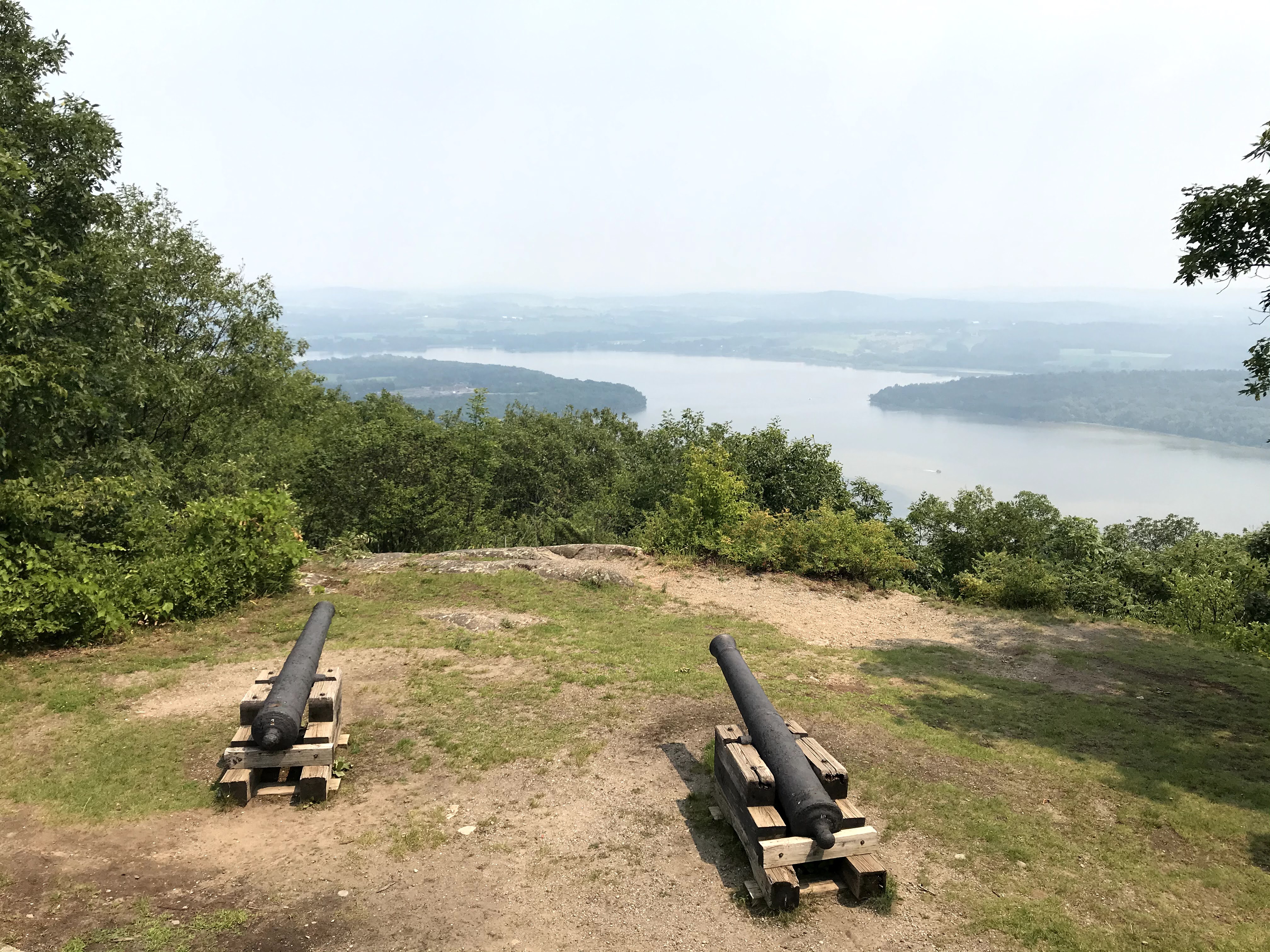
We hike up to the top of Mount Defiance that overlooks Fort
Ticonderoga, barely visible thru the smoke from the CA fires.
  A year 
after the Americans took the Fort, Borgonne had his
troops 
drag two cannons up the mountain to fire on the Fort.
While 
the cannonballs may not have reached that far, the
threat was 
enough to get the Americans to evacuate. 


The waterfall in Vergennes was lit up at night.

The Vergennes Community Band was excellent.

Fort Ticonderoga is actually operated by a private foundation.  They employee a number of staff
to play the part of soldiers and various people of 250 years ago.

Throughout our trip all the vegetation was very green from all the rain.

We anchored in the Hudson River near the entrance to Saratoga National Historic Park.  After an
8-mile hike to and through the Park, Tory was ready for a swim before we dinghied back to Salty Paws.

The sign in Waterford, NY designates the beginnings of the Erie Canal and the Champlain Canal.
Our cruise to here connected the dots to our travels of two years ago.

The USS Ticonderoga - see pictured plaque.